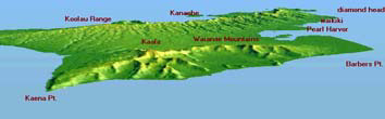
(1)Oahu isle., Hawaii, view from over Kauai channel.
Rendered by MoV(using unofficial functions), using USGS 3'DEM.
1995.
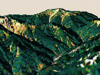
(2)Mt. Senjo-dake, Yamanashi, view from over Mt. Senzubosi-yama.
Rendered by MoV, using 50m-mesh DEMs and a Landsat image.
1995.
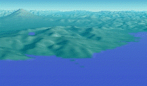
(3)Mt. Hakone, Kanagawa, with Mt. Fuji. View from over Odawara city.
Rendered by MoV, using 250m-mesh DEMs(The sea level was modified upwardly.).
July 10, 1996.
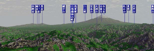
(4)The simulated view from Mt. Tounotake, Kanagawa. Mt. Fuji and some visible mountains were indicated in Japanese.
Rendered by Kashmir NEXT, using commercial elevation data.
April 27, 1997.

(5)Rendered Mt. Fuji, view from Mt. Hijiri-dake, Shizuoka.
Rendered by MoV, using 250m-mesh DEMs and a Landsat image.
May 19, 1997.
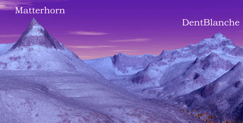
(6)Matterhorn and DentBlanche from Gornergrat, Switzerland.
Rendered by VistaPro, using commercial elevation data.
June 16, 1997.

(7)The title are put on an ellipsoid.
Visualized by Bryce 2, using Landsat images.
July 3, 1997.
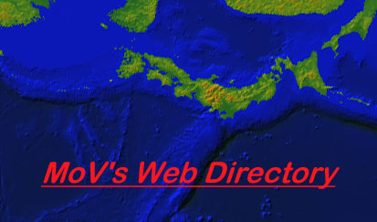
(8)Japan and nearby bottom of the sea.
Visualized by my own software, using NGDC data.
July 6, 1997.

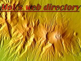
(9)The title are rendered on the waving surface.
Rendered by Bryce 2, using Microsoft fonts.
July 21, 1997.
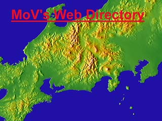
(10)The central high-land of Japan.
Rendered by my own software, using USGS DCWDEM data.
Aug. 28, 1997.

(11)Mt. Yarigatake and Mt. Hotaka.
A plastic figure curved by myself. produced in Summer, 1987.
Sep. 2, 1997.

(12)Mt. Fuji and the full moon. A view from Mt. Ainodake(Shizuoka and Yamanashi).
Rendered by MoV, using 50m-mesh DEMs.
月の出入りの位置は太陽よりも大きく変動するので、ダイヤモンド富士が見られない地域からも、 月と富士山が重なって見えることがあります。このタイトル画像は、1988年6月に見られたかもしれない(当日の天候は検討していませんが)、間の岳から の富士山と満月のシミュレーション画像です。1999頃
Oct. 16, 1997.
(13)Mt. Asama.
Rendered by my own software, using 50m-mesh DEMs.
Oct. 16, 1997.

(14)Rising sun. A vista from Mt. Tounotake, Kanagawa.
Jan., 1998.

(15)Mt. Fuji at sunset, from Akouji, Fujinomiya city(Shizuoka).
Photographed by Olympus C1400L. Mar., 1998.

(16)Grand Canyon vista from an airplane's window connecting Baltimore and Los Angeles.
Photographed by an Olympus C1400L. Nov. 1, 1998.
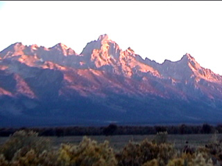
(17)Grand Teton in the sun beam at dawn.
Photographed by a Sony Digitral8 HandyCam. Sep., 1999.