 Japanese version's here
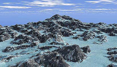
VISTAPRO, Bryce3D, Scenery Animator, CH System, Kashmir/Map Brothers, LAND3D, World Construction Set, World Builder, Truflite 3D, Visual Explorer, Digital eXchange Engine, MGE Terrein Modeler,
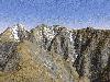
Digital Maps (Japan, domestic), U.S.G.S. DEMs, GLOBE, U.S.G.S. GTOPO30, ASTRO P/G, Free DEMs(Jspan, domestic), 'Home made' data on line, U.K., Mars, Venus, 'My own' data,
Landsat, Space Shuttle, Noaa (Japan, domestic), Photos from Air-plane, Commercial Satellite Imagery, etc.(in preparation)
 Vista PRO 3.0 Bryce3D(KPT Bryce/Bryce2)Scenery AnimatorCH SystemMap BrothersWorld Construction Set V3Animatek's WorldBuilderTruflite
web page is here. I have had a letter from the producer. Please check his comments with an image.
Visual ExplorerDigital eXchange EngineIntergraph's MGE Terrain ModelerEtc.Digital Maps (Japan, domestic)
 the elevation data from U.S.G.S.
 Please check U.S.G.S. and their
EROS data center webpages.
You can also get 7.5" DEM from personal
mirror site .
.
GLOBE
Please check
here
Now under investigation.
U.S.G.S. DCWDEM 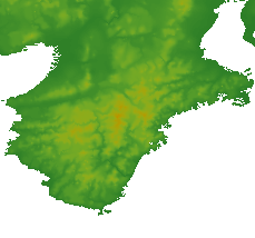 Digital Chart of the World derived DEM.
Please check Please check U.S.G.S. and their
EROS data center webpages.
ASTRO P/G
Japanese domestic data.
"Hand made"dataFree DEMs(JAPAN, domestic)DEM in U.K.Check here.Not free.:-)
MarsI know two DEM sets of Mars(but almostly the same).
The first one is on SINUSOIDAL EQUAL-AREA PROJECTION.
The aspect ratio will be correct, but it's difficult to tie adjoined
regions together.
You can purcahse the Digital Image Map of Mars directly by NASA.
Digital Terrain Model appears on the Volume 7.
The second one is arranged with latitude and longitude.
The aspect ratio will be seriously distored near the poles, but easy to
tie together.
I have once found them at some university's site, but
I've never succeed to discover the data again on the Internet.
Although, you can get the data in the commercial software
(CD-rom version of VISTAPRO).
I've reconstructed the Mars topographic data with VISTAPRO and the data
in it.
The movie here is the one.(I made it years ago, then it looks so
out-dated)
Please check
NASA,
Atlas, and
CD-ROM.
Venus Please check
NASA,
Venus map,
CD-ROM,and
5km mesh Topographic image
etc.Australia Not free
Canada Not free
catalogue of Degital elevation data
Hand-made datain preparation
Landsat
 Published by U.S.G.S.
Photos from Space Shuttle
WWW Page's here.
Example:Nagoya city (Japan)
Photos from airplanes
Published by G.S.I. of Japan.
Commercial Satellite Imagery
For example:
EarthWatch
Return toMoV's Web Directory
 Please e-mail your comment or quiestion to